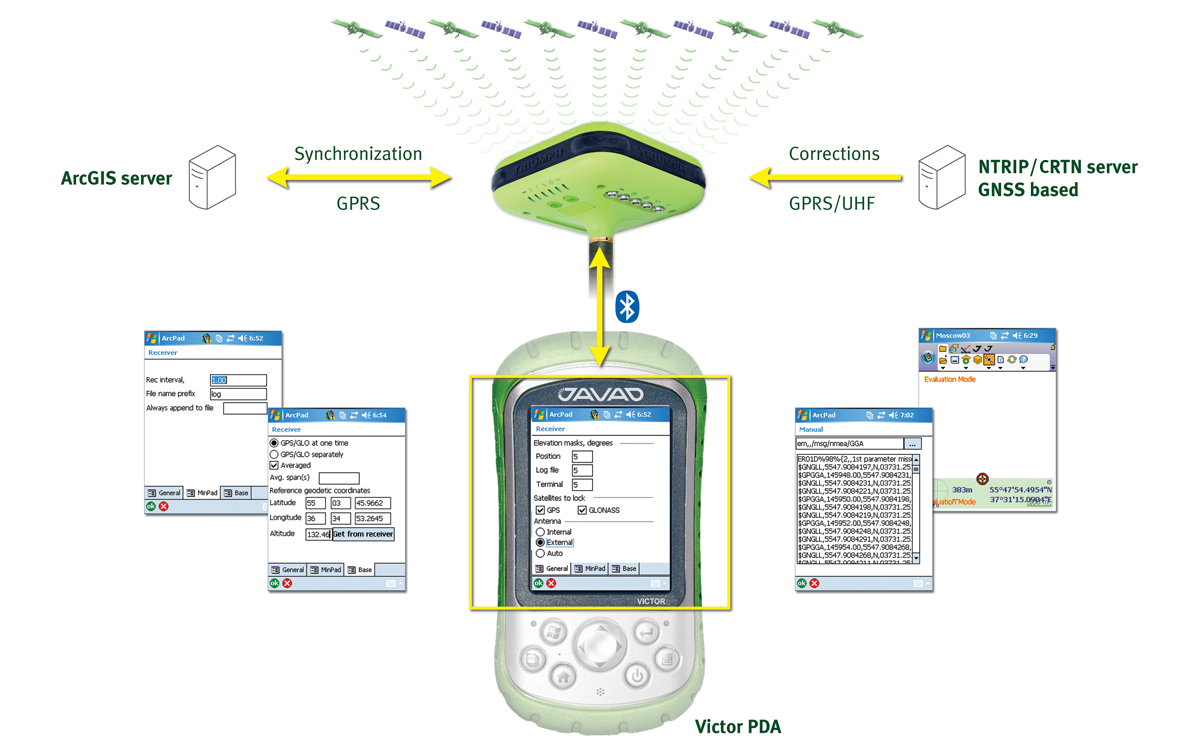
JAVAD ArcPad Extension enhances the spectrum of ArcPad's surveying capabilities by adding state of the art JAVAD GNSS solutions. JAVAD ArcPad Extension provides a full range of functions to control the GNSS receiver and manage the surveying process. Broadcasting/Receiving differential corrections and synchronizing ArcPad with ESRI ArcGIS Server is enabled by utilizing advanced wireless communication technologies such as Bluetooth, GPRS, and UHF. Note that JAVAD ArcPad Extension uses the receiver's internal GSM modem so no additional devices (external radio) or settings are required.
JAVAD ArcPad Extension establishes a connection to the receiver via serial, USB, or Bluetooth. Users will find software dialogs familiar as they are similar to the mapping/surveying software tools they have used in the past.
Only three buttons are needed to control data logging, configure the base station parameters that govern the RTK and UHF radio setups, and GSM modem settings.
Quality control of real-time positioning results are assured in the field. The JAVAD GNSS Victor PDA displays the status/process progress continuously via the Bluetooth connection to the receiver. With the Victor's graphical user interface, the operator can perform basic file manipulation operations such as start/stop data logging, delete files, initialize the internal file system, etc. Should the user need customization of the receiver's parameters, a terminal software emulation utility allows executing individual commands or entire scripts written in the GREIS interface language.
Advanced RTK accuracy and ArcPad vector/raster map visualization capabilities deliver reliable object positioning and a new level of job control in the field. Coupled with GIS server synchronization, JAVAD ArcPad Extension adds new functionality to surveys thanks to professional management and coordination of group work.
JAVAD ArcPad Extension is an optimal ESRI-compatible solution for a wide variety of civil engineering or cartography tasks where centimeter level accuracies are required.
At the core of this solution lies highly integrated JAVAD GNSS technology optimized for use with ESRI's GIS software.